Tyne & Wear Archives holds thousands of fascinating collections covering an amazing variety of subjects. There are so many interesting collections that it would be very difficult to pick a favourite. Two kinds of documents do have a special place in my heart, though – old maps and aerial photographs. I’m lucky that the Archives is blessed with many fine examples of both.
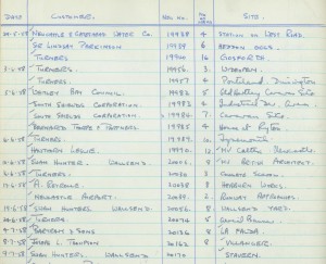
The extent of these was brought home to me after I recently discovered a register of aerial photographs in one of our strong rooms. The register belonged to the photographic firm Turners Ltd and documents their aerial photography work between 1957 and 1980.
Turners was based in Pink Lane, Newcastle upon Tyne and we hold hundreds of boxes of negatives kept by the firm from 1947 to 1990. These include a large quantity of aerial photographs commissioned by businesses and organisations showing their premises and major building projects. There are also many aerial views of ships on their sea trials, taken on behalf of shipyards in the North East. These are fascinating but those that really capture my imagination are the aerial photographs that Turners took on their own account of cities, towns and villages throughout the North of England.
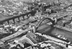
A lovely example of one of these is this image of Newcastle upon Tyne dating from March 1948.
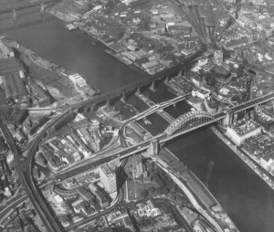
For comparison here is a very similar view taken by Turners in June 1970.
It’s interesting to see a few changes such as the addition of a tower block behind St Mary’s Church, Gateshead. It’s also noticeable that the Gateshead side has really been redeveloped since 1970.
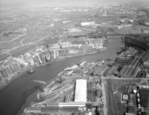
Just as good is this view of the River Wear taken in May 1965 showing amongst other things the shipyards of William Doxford and Sons Ltd at Pallion and Austin & Pickersgill Ltd at Southwick.
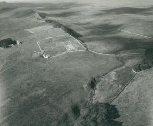
The Turners collection doesn’t just cover the major cities of the North East but also documents their suburbs as well as towns, villages and historic sites. One of the historic sites photographed by Turners was Hadrian’s Wall. Here’s an image of Housteads Roman Fort, one of 38 photos of the Wall taken on 8 October 1963.
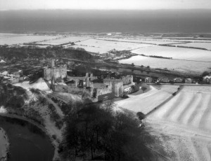
Given all the snow that’s fallen this year, I thought it would also be nice to show this lovely image of Warkworth Castle, taken in January 1959.
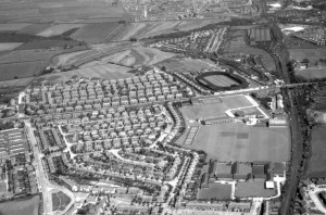
The images are fantastic evidence of how the Region’s landscape has (and hasn’t) changed since the 1950s. They can be great sources for tracing the development of your neighbourhood or your house. Aerial photographs can even help in resolving boundary disputes. This next view shows the Grange Park estate in Gosforth as it was on 15 June 1965. It’s one of seventeen aerial shots taken of Gosforth and Fawdon on that day.
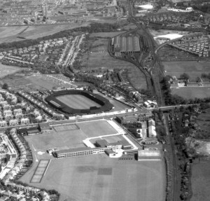
I find it fascinating to look at an area and see how it’s changed over the course of nearly 50 years. The stadium to the right of the picture (then home to Northumberland Rugby Union and Gosforth Greyhound Stadium) has now been replaced by a supermarket.
The railway line running close by is now part of the Tyne & Wear Metro system, although in 1965 there was no Regent Centre. It’s also interesting to see how the premises of Gosforth Academy have changed since then (when it was known as Gosforth Grammar School).
The newly discovered aerial photography register kept by Turners gives us an opportunity to really open up access to the thousands of aerial views we hold. You’re very welcome to come and take a look at the register in our public searchroom to see whether we have any aerial photographs of interest to you. Our location and opening times can be found on our website.
You may be interested to know that we sell high quality A3 prints of many of our aerial photographs. These can be sold on their own or alternatively can be mounted and framed by our professionally qualified conservators. Three historic aerial photographs for the Gosforth area (covering Brunton Park, Melton Park and Grange Park) are already available for sale in our Online Shop. We also sell high resolution digital copies of these and many other images from our collections. Please e-mail us (archives@twmuseums.org.uk) for further information.
In the long run the best way to widen access to these treasures will be to digitise the negatives and make them available online. One way to do this would be to add these images to our existing sets on Flickr Commons. Do historic aerial photographs interest you? If you would like us to make them available online please let me know – your advice and comments are important in helping us to improve our service.
5 Responses to Do we have historic aerial photographs of your neighbourhood?