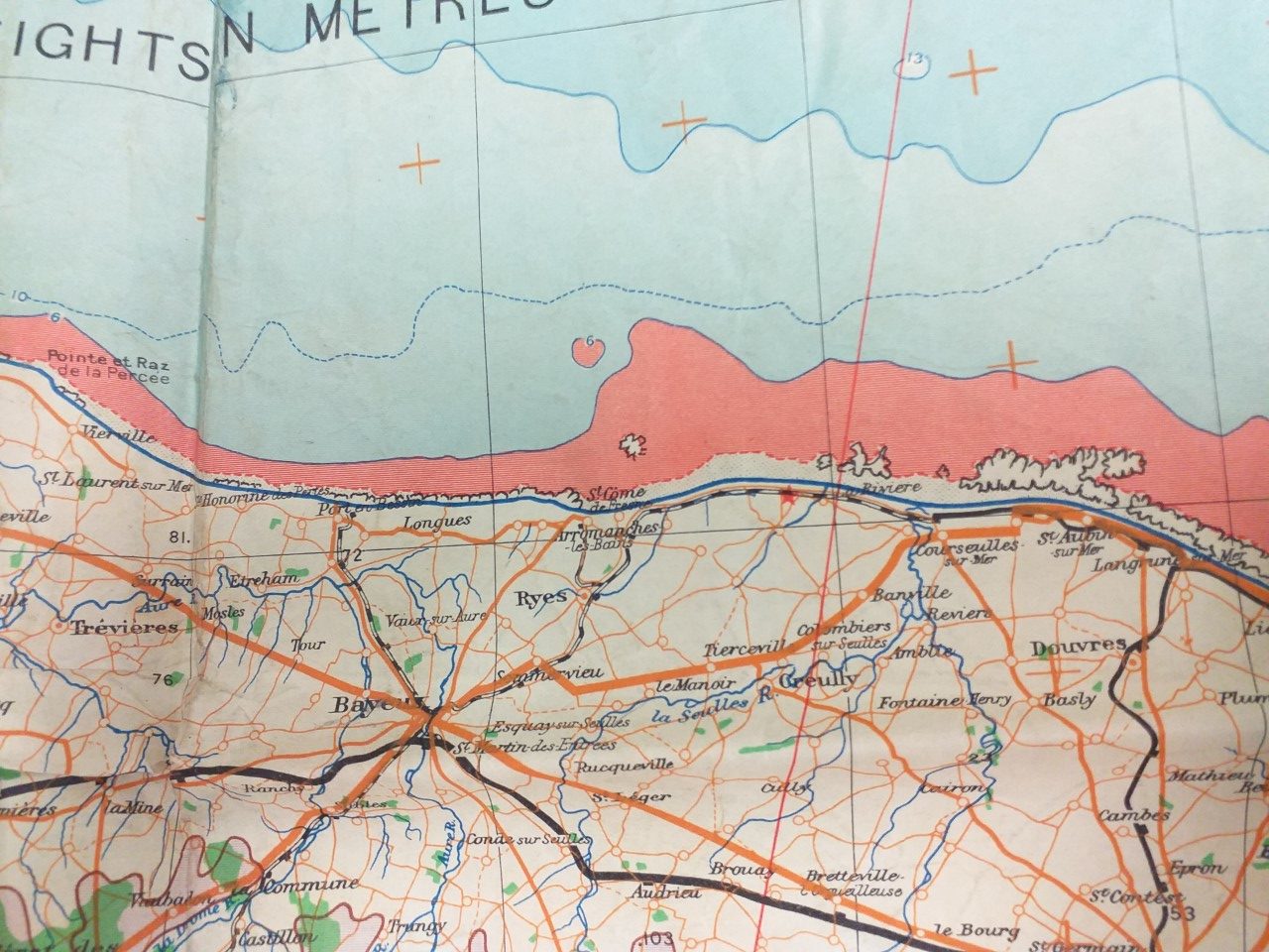
This close-up of a section of the 1943 Edition War Office map of Cherbourg and the area of the D-Day beaches in Normandy shows the location of Gold beach. LCT 7074 landed its tanks between Arromanches les Bains and La Rivière. The map belonged to Lieutenant Peter Saward of the Royal Engineers, who was involved in the D-Day landings.
Loaned by Geoff Woodward